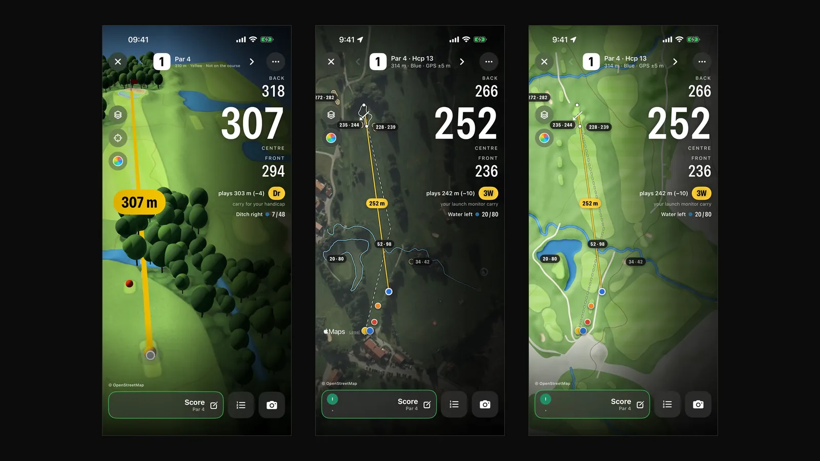
Hole 4 at Golfclub Oberstaufen-Steibis is 458 metres long. If you laser it and pick your club by that number, you'll go long. The green sits 26 metres below the tee, and the course lies at 926 metres above sea level. The hole plays like 419 metres.
That's what plays-like distance is for: the distance a shot really plays once elevation change and altitude are taken into account. Here is how it's calculated and how to use it on the course.
The formula
In the DeepSwing golf course GPS we calculate it like this:
- Distance plus elevation change. If the target is higher, the elevation change is added; if it is lower, it's subtracted. One metre of height counts as one metre of distance.
- Divided by a factor for the air. At altitude the air is thinner and the ball flies further. We use about one percent per 290 metres above sea level.
For hole 4 at Steibis that means: 458 metres minus 26 metres of drop gives 432 metres. Divided by 1.032 for 926 metres of altitude gives 419 metres.
Three examples
| Situation | Distance | Elevation | Altitude | Plays like |
|---|---|---|---|---|
| Steibis, hole 4 | 458 m | 26 m downhill | 926 m | 419 m |
| Steibis, hole 1, blue tee | 313 m | 1.9 m downhill | 899 m | 302 m |
| Worked example | 150 m | 10 m uphill | sea level | 160 m |
| the same in the mountains | 150 m | 10 m uphill | 1,000 m | 155 m |
The last example shows why both belong together: uphill the shot plays ten metres longer, and at 1,000 metres the thin air gives five of them back.
On the course: distance, plays-like and club
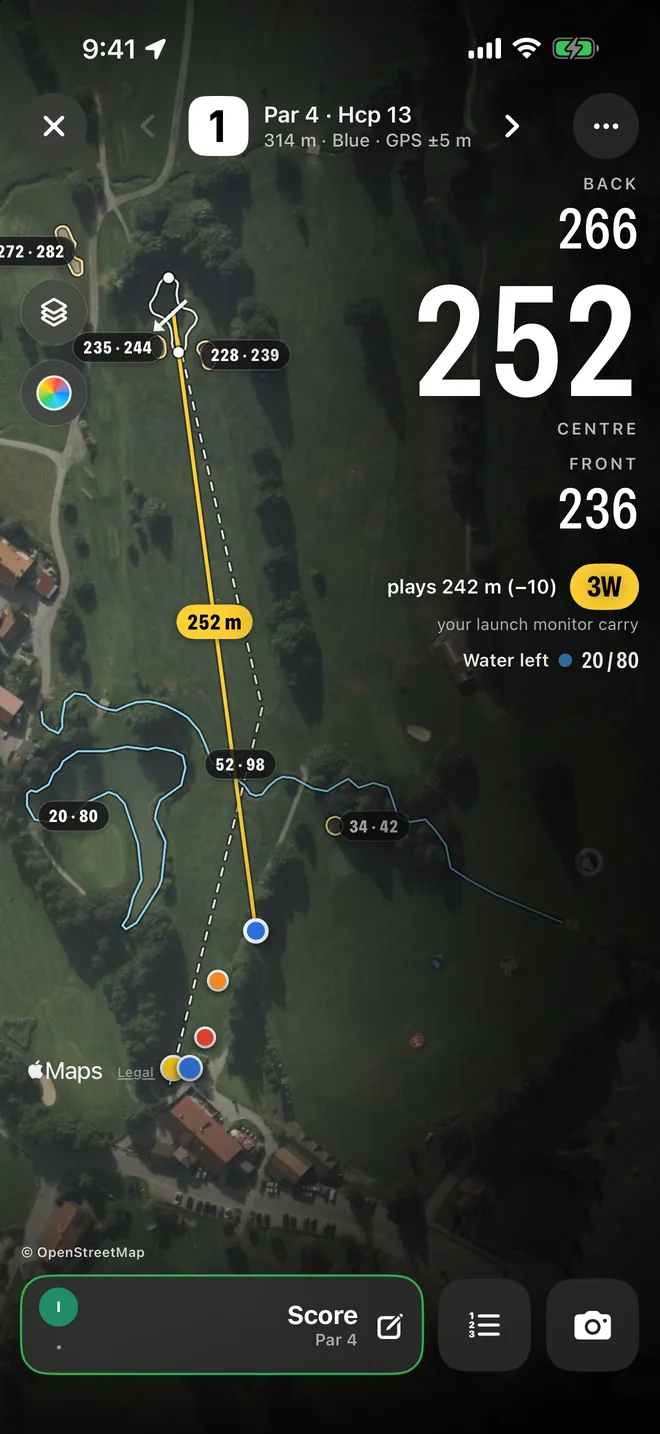
On the hole the app shows the distance to the front, centre and back of the green, live to your position. Below it you see how the shot plays, "plays 242 m (−10)" in the example above, and which club fits.
Where does the club come from? If you use the DeepSwing launch monitor, from your own measured distances. Without measurements, the app uses typical distances for your handicap. How to get reliable distances per club is in Launch monitor numbers explained.
For hazards the app shows two numbers: how far to reach them and how far to carry them. "Water left 20/80" means the water starts after 20 metres and is cleared after 80.
Why the elevation data matters so much
A plays-like distance is only as good as the heights behind it. Many apps use global satellite elevation models. Those often measure the top of the trees instead of the ground. We checked: a global model was on average 2.05 metres off the official terrain and up to 7.9 metres off on one hole.
We use laser-scan elevation models; in Germany, the state survey's DGM1 with a one-metre grid. Against the official original, our heights are within 0.01 metres. How the course data comes together overall is explained in Course AI: how we map golf courses from aerial imagery.
Satellite, map or 3D?
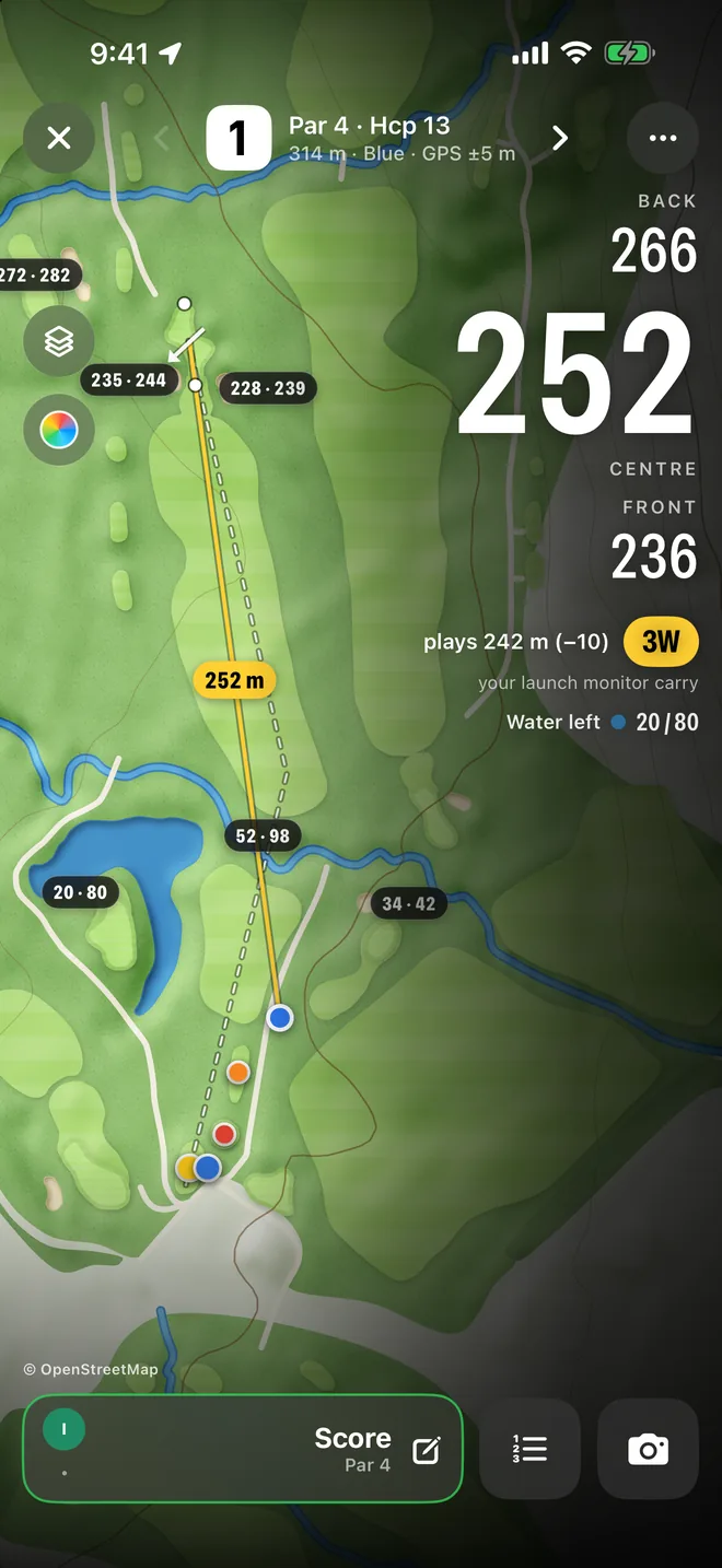
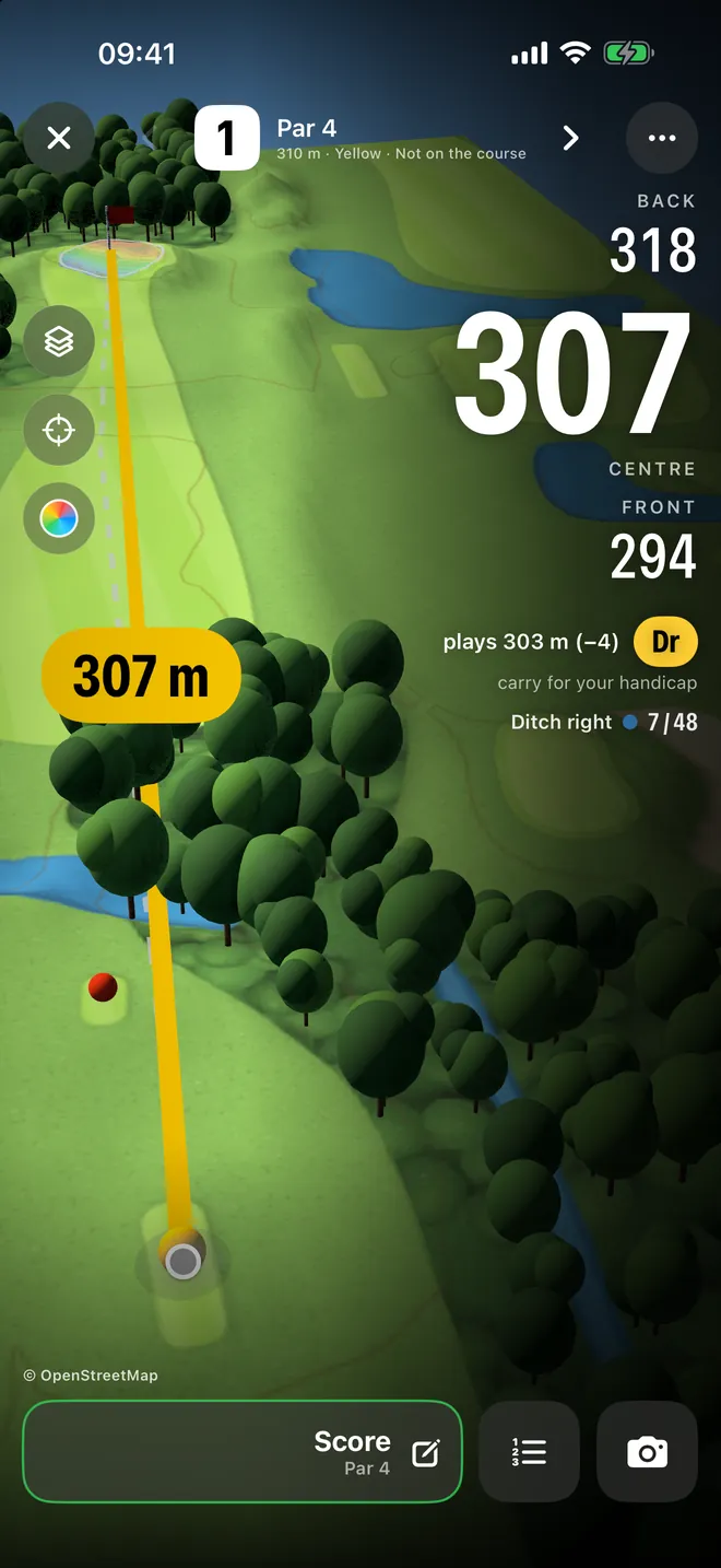
Every hole comes in three views. The satellite image shows the course as it looks. The map is drawn by us from the course data, with terrain relief, and it works without a network. The 3D relief reveals slopes and hollows you can hardly see from above. The distances are the same in all three views.
What's not in the number
Plays-like distance accounts for elevation change and altitude. Wind, temperature and a wet or firm landing area are still yours to judge on the course. A good routine: read plays-like first, then adjust for wind, then pick the club.
Frequently asked questions
What does "plays like" mean in golf?
The distance a shot really plays: the measured distance corrected for the elevation change to the target and for the course's altitude.
How much does one metre of elevation change matter?
In our model, one metre of distance. Ten metres uphill plays ten metres longer, ten metres downhill ten metres shorter, before the altitude correction.
Does the ball fly further in the mountains?
Yes, because the air is thinner. We use about one percent per 290 metres above sea level. At 900 metres a shot therefore plays a good three percent shorter than the distance says.
Can I use plays-like distance in a tournament?
Plain distances are allowed under the Rules of Golf unless the committee prohibits them with a local rule. Elevation information is not allowed in competition rounds. So for tournaments, use the distance only.
Plays-like on your course: the DeepSwing golf course GPS, free on iPhone.