Vision AI that thinks on the device.
We build object detection, body tracking and mapping AI that runs in real time on phones, wearables and IoT devices. No cloud. Proven in DeepSwing, the launch monitor in your iPhone.
- real-time object detection
- 240fps
- carry deviation from radar
- 0–2%
- golf courses captured by our course AI
- 40,057
Fig. 01 — Swing plane and club head trail, detected live on the iPhone. Real footage from the range.
01 — Thesis
An iPhone carries more computing power in your pocket than a 600-dollar radar launch monitor. We turn it into a measuring instrument.
02 — Live from the pipeline
From the first frame to ball flight.
-
01 / 240 fps
Every frame is a measurement.
The camera films at 240 frames per second with 1/8000 s exposure. Sharp enough to freeze a golf ball in flight.
-
02 / Armed
Ball detected. Armed.
The model finds the ball on the mat, locks it and waits for the strike. Full precision is spent only when it counts.
-
03 / 145 km/h
Club head acquired.
Our own YOLO model detects the club head frame by frame, milliseconds before impact, and measures its speed.
-
04 / 186 km/h · 13.3°
Ball flight computed.
A few frames after impact give ball speed, launch angle and direction, and from those the entire flight.
03 — Object detection specialists
We see what others miss.
Three models, one goal: making motion in sports measurable, on the device, in real time.
A — Club head
The path of the club.
Trail through the whole swing: plane, path and tempo, frame by frame.
Learn moreB — Ball
43 mm. 240 fps.
Resting ball, impact, launch: detected and measured in a few frames.
Learn moreC — Body
Six phases, thirty checks.
Pose tracking that reads a swing the way a coach does.
Learn more04 — DeepSwing Launch Monitor
The launch monitor is now an app.
No radar. No sensor. An iPhone on a tripod measures every shot and shows it on the phone, the iPad, the Mac or big on a projector.
- Carry
- 123m
- Ball speed
- 159km/h
- Launch angle
- 15.8°
- Direction
- 2.6° L
- Ball speed
- Club speed
- Launch
- Direction
- Carry
- Total
- 12,000+ courses
- Daily challenge
- Up to 4 players
- Live duels
- Projector & TV
- GSPro
- Putting
0–2%
carry deviation from a radar launch monitor (Rapsodo MLM2 PRO), depending on the club.We estimate spin. And we say so.
05 — Our course AI
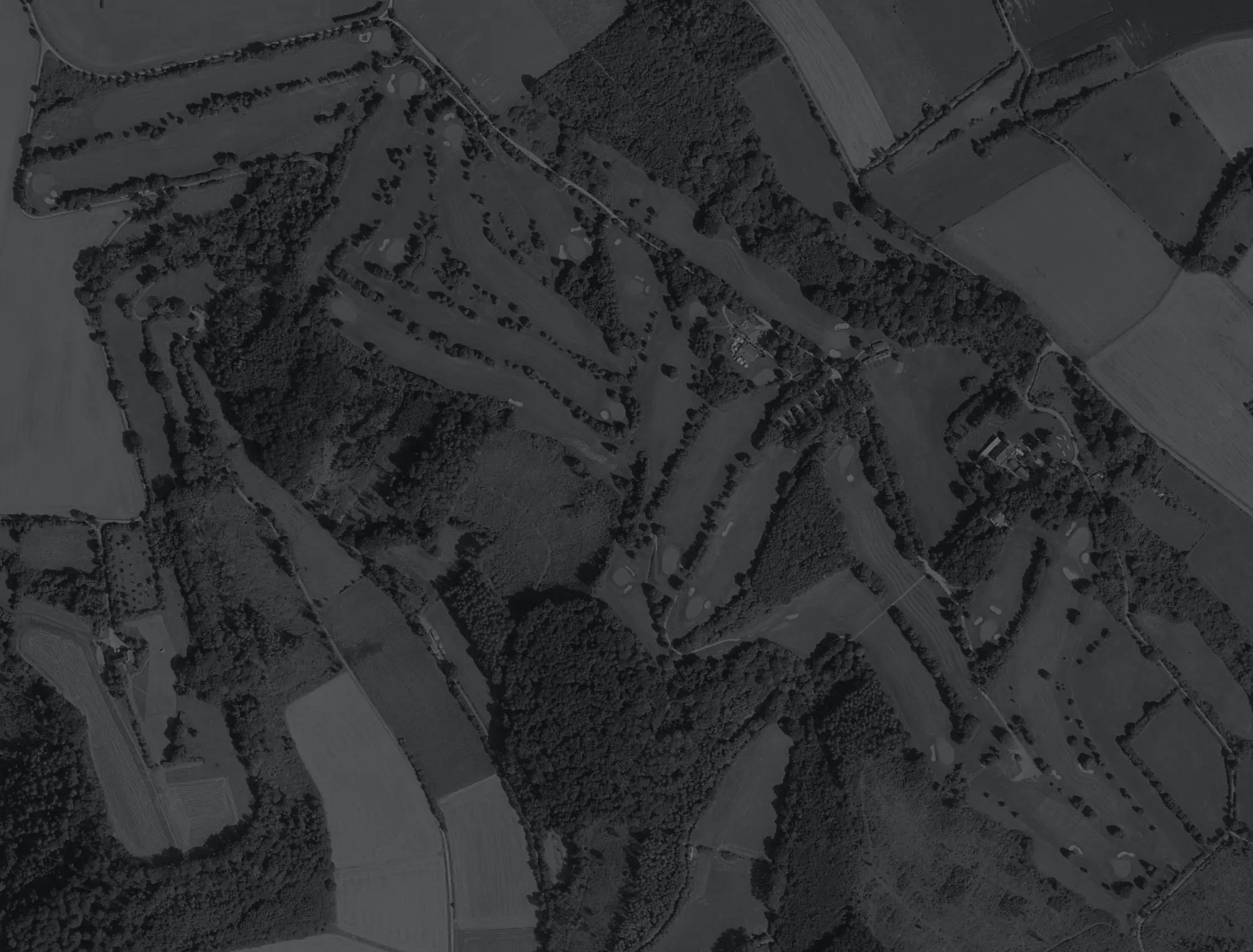
We taught an AI to read golf courses.
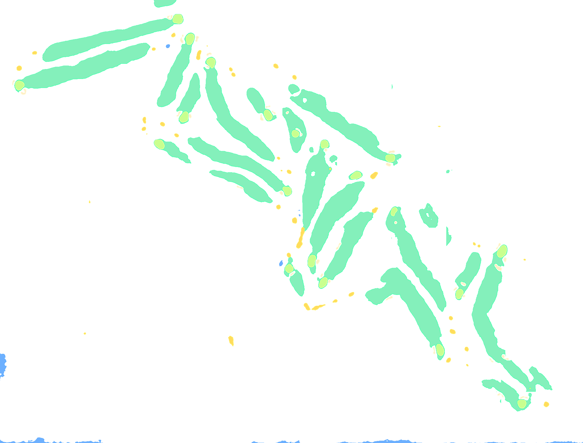
Our own segmentation model draws fairways, greens, tees, bunkers and water onto aerial images. A second one assembles the holes. Here it runs on a course it never saw in training.
- Fairway
- Green
- Tee
- Bunker
- Water
- of greens found
- 99%
- precision on greens
- 96%
- green centre error (median)
- 0.6m
- of bunkers found
- 94%
Fig. 05 — Golf-Club Bad Pyrmont, validation course. Aerial image: Geobasis NRW (dl-de/zero-2-0). Segmentation: Deep Platforms course AI.
40,057
golf courses captured worldwide
10,229
of them GPS-ready
512
regions processed
06 — Golf course GPS
12,000+ courses. Free on iPhone.
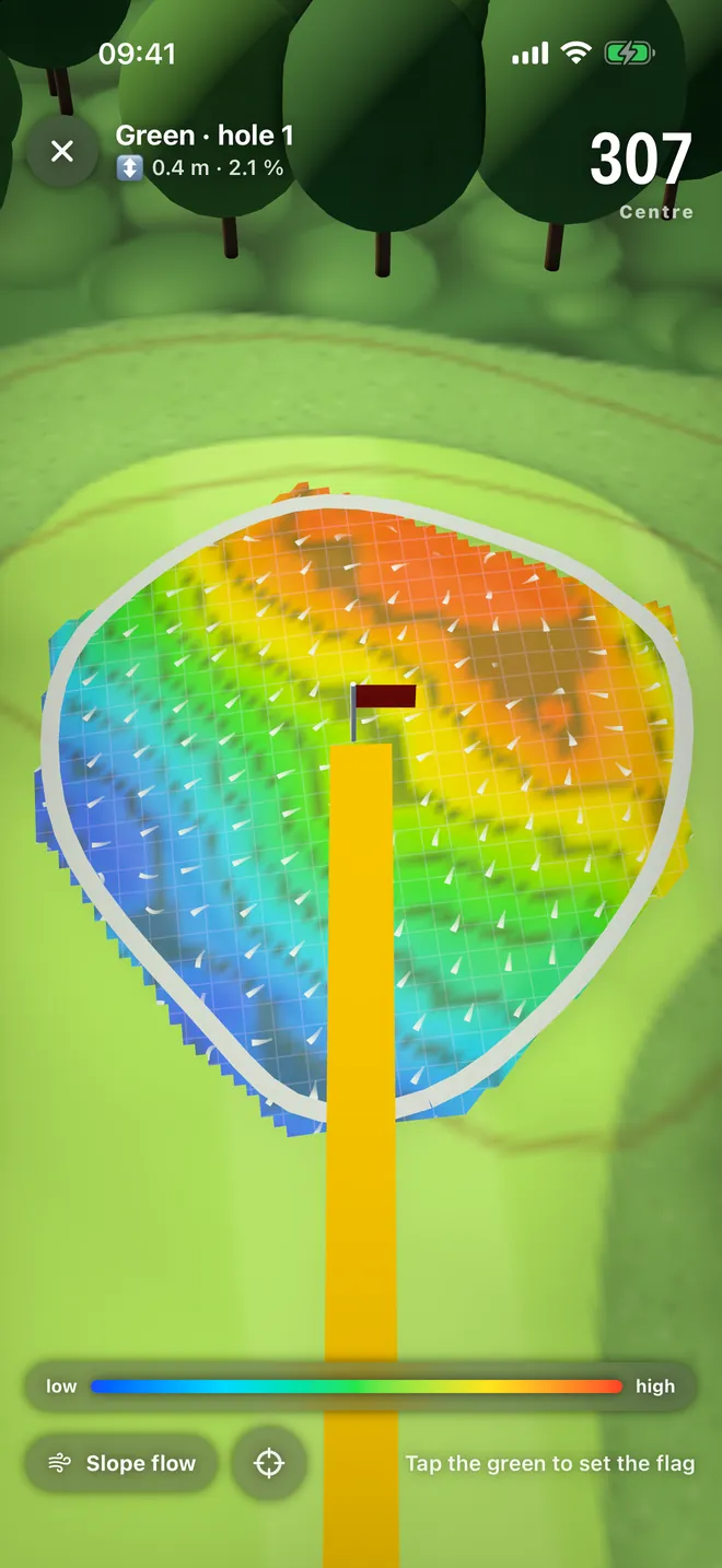
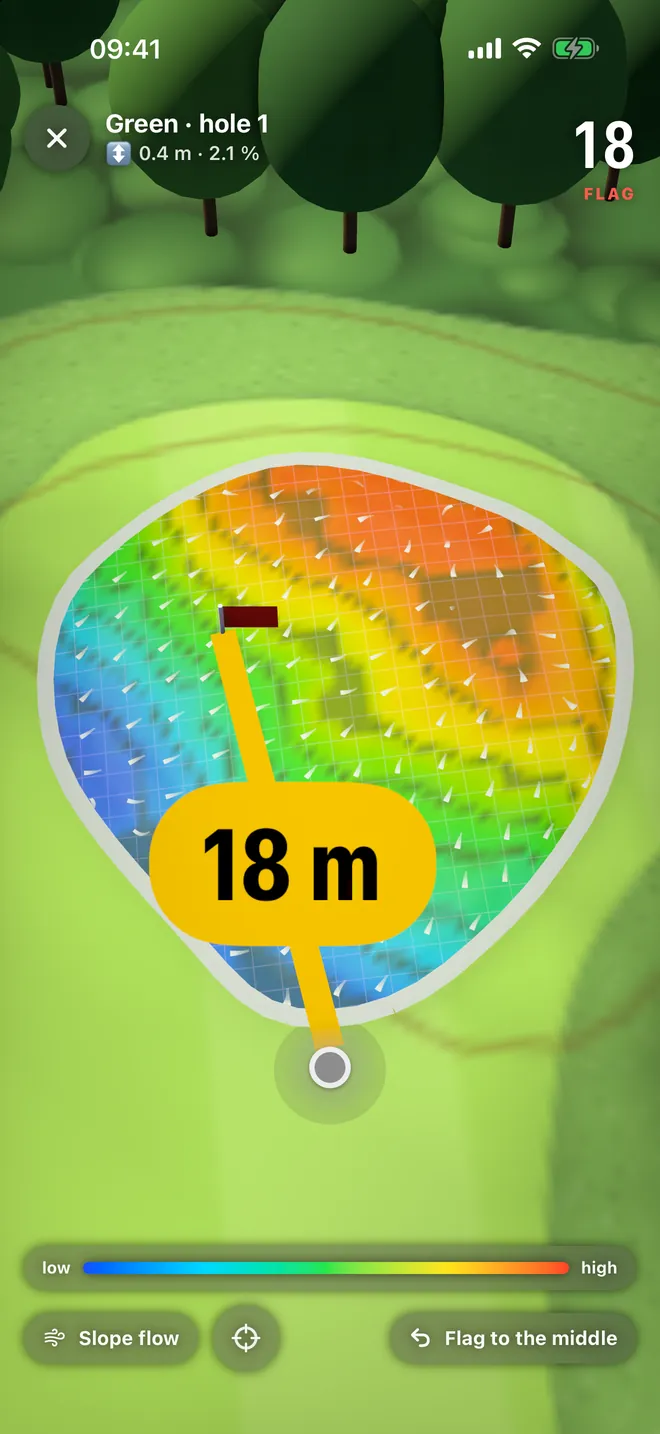
What the course AI maps becomes GPS in DeepSwing: distances to green and hazards, plays-like with elevation, green heatmaps and a scorecard with handicap. On Apple Watch too, even without iPhone.
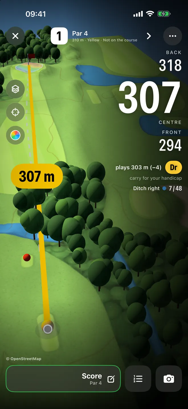
- 01Front, centre and back
- 02Hazards with reach and carry
- 03Plays-like with club suggestion
- 04Green heatmaps
- 05Scorecard and handicap
- 06Apple Watch and Dynamic Island
07 — Cartography
Terrain in centimetres.
Laser-scan elevation models, 1-metre grid, 0.01 metres off the official model. From it come contour lines, green slopes and the distance a shot really plays.

Hole 4 · Par 5
Golf Oberstaufen-Steibis
- on the map
- 458m
- plays like
- 419m
26 m downhill, 926 m above sea level: thinner air, longer flight.
08 — Smart data fusion
One shot. Seven data sources.
The connection is what makes the number valuable. We combine what camera, map, terrain and physics know.
- 01DistanceGPS position to the front, centre and back of the green.
- 02ElevationHeight profile every 5 m along the hole from LiDAR.
- 03Air densityAltitude, about 1% more distance per 290 m.
- 04WindDirection and strength in the ball flight model.
- 05Ball flightSpeed, launch and direction from the launch monitor.
- 06SwingPhases and checks from body tracking.
- 07GreenSlope and fall line on a 1-m grid.
09 — Ball flight in 3D
Fast camera moves. Real terrain.
Every shot is flown again in 3D. The camera chases the ball across courses whose terrain comes from real elevation data, from the Swiss Alps to the Sonoran Desert.
10 — DeepSwing
Coach, launch monitor and GPS. One app.
Everything we can do in vision AI, in one golf app. For iPhone, iPad, Mac, Apple Watch and Android, in 22 languages.
A — Coach
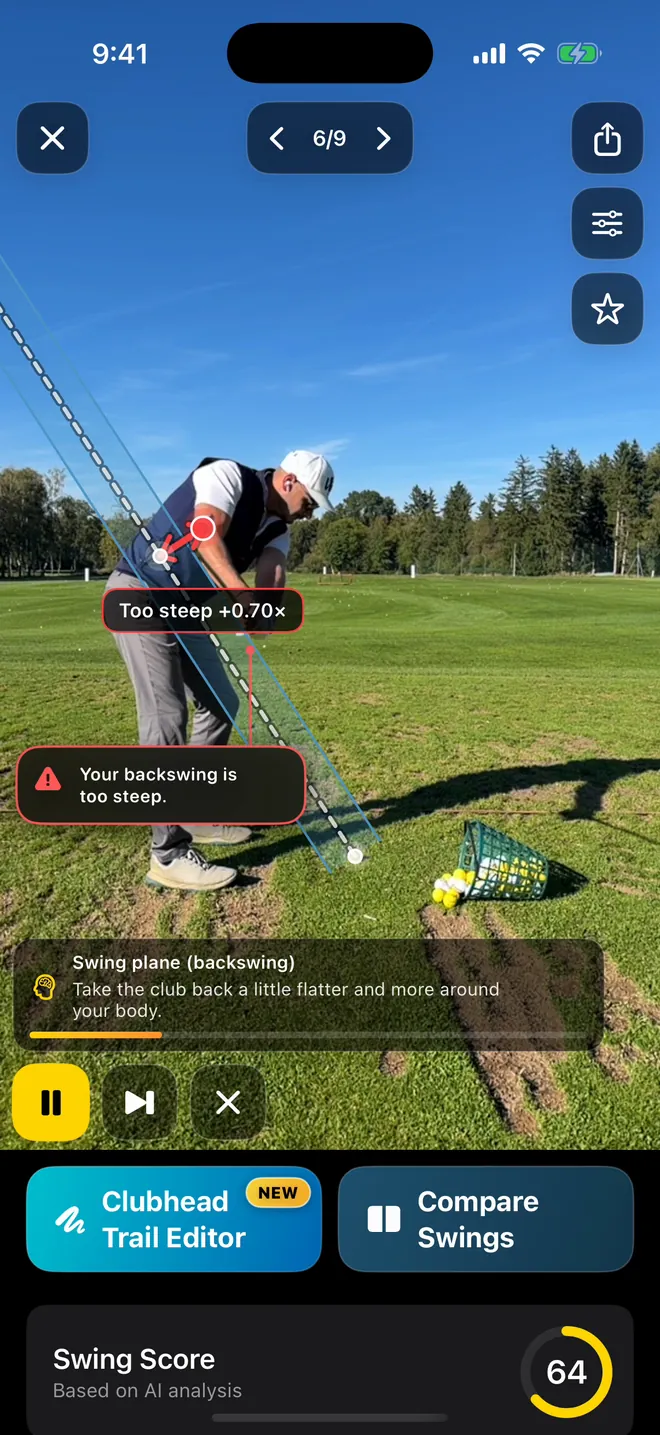
Sees what your coach sees.
- 6 swing phases detected automatically
- 30 checks with ratings
- Live coach with spoken feedback
- Club head trail and swing plane
B — Launch monitor
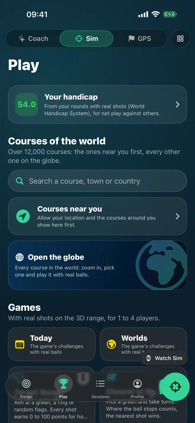
Your phone measures every ball.
- Range, daily challenge and mini games
- Live duels, up to 4 players
- iPad, Mac, TV or projector as the screen
- Connects to GSPro
C — Golf course GPS
Every hole. Every distance. Every green.
- 12,000+ courses worldwide
- Plays-like with elevation
- Green heatmaps with slope
- Scorecard and handicap
€0
golf course GPS on iPhone
5
free launch monitor shots a week
€8.99
launch monitor a month, no hardware
11 — Why Deep Platforms
Measure more. Carry less.
| Feature | Deep Platforms | Radar hardware | Typical golf apps |
|---|---|---|---|
| Works without an extra device | Yes | No, device from about $600 | Yes |
| Launch monitor and swing analysis in one app | Yes | No | Rarely |
| Own object detection for club and ball | Yes | Radar, not camera | Rarely |
| Body tracking with 30 checks | Yes | No | Partly |
| Courses on real LiDAR terrain | Yes | Sometimes, paid extra | Rarely |
| Own course AI from aerial imagery | Yes | No | No |
| On-device analysis, no upload | Yes | Partly | Rarely |
Comparison based on publicly available product information, as of October 2026.
12 — For partners
Your vision AI. Built by us.
What we built for golf works wherever cameras need to recognise something in real time: sports, health, industry, agriculture, smart home.
- 01Sports & fitness
- 02Movement & physio
- 03Industrial inspection
- 04Agriculture & geodata
- 05Smart home & IoT
- 06Wearables
13 — More products
More from our studio.
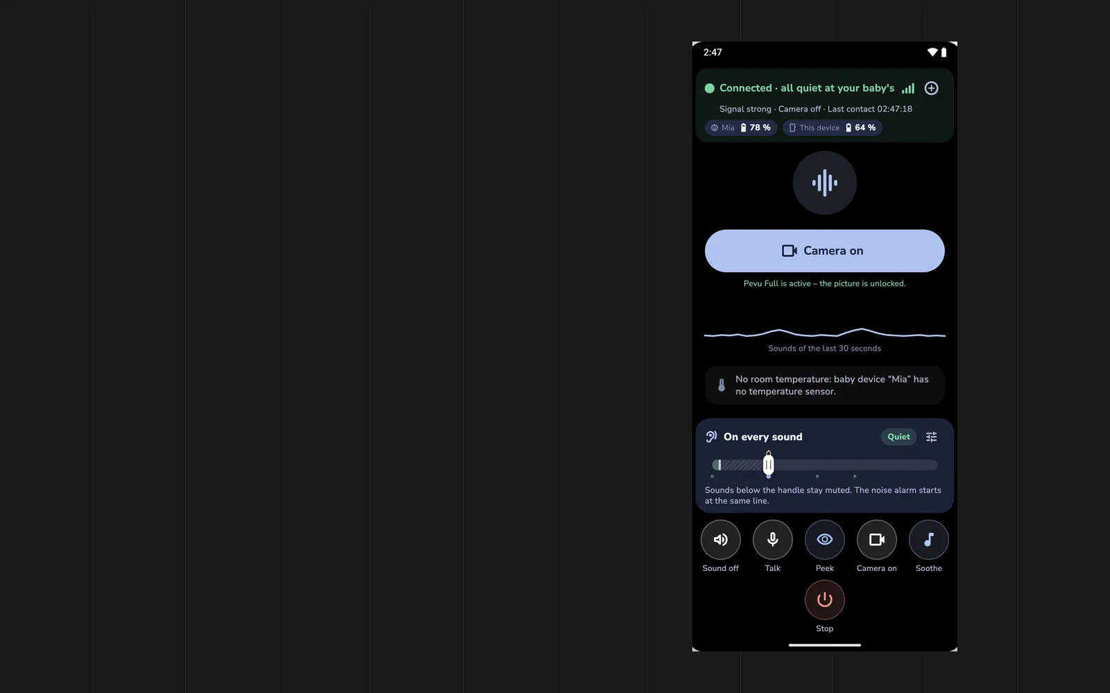
Besides DeepSwing we build and run more products, from AI in sales to a baby monitor without a cloud.


Acvire
AI sales OS for B2B teams
Find target accounts, enrich data, review AI outreach, steer follow-ups and manage deals. Automation with human approval, soon self-hosted with your own LLM.

Metalisto
Truly compare precious-metal prices
Compare gold, silver, platinum and copper live: spot price, premium, shipping, spread and break-even. The actual best buy instead of the loudest offer.

FileSizeFix
Shrink files, without upload
Compress images, videos, PDFs and Office files right in the browser or app. Processing runs on the device, your files stay with you.

DeepSales
The smart sales CRM
Sales without the baggage: a lean CRM for startups and small sales teams that makes selling feel light.
14 — From the lab
Latest from the blog
All articlesLaunch monitor numbers explained: ball speed, smash, carry
Ball speed, smash factor, launch angle, spin, carry and landing angle: what a launch monitor's numbers mean and which ones really improve your game.
Golf simulator at home with your phone: setup and costs
Net, mat, light, screen and a phone on a tripod: what a golf simulator at home really needs, how much space it takes and what it costs.
How to connect GSPro to your phone as a launch monitor
Step by step: how DeepSwing sends every shot from your iPhone or Android phone to GSPro on the PC, with fixes for the usual connection problems.
Contact
What should your camera recognise?
Object detection, body tracking, segmentation or cartography, on your device, in real time. Let's talk about it.